GPS and Land Surveying

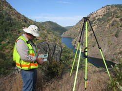
Land surveying is a profession that greatly utilize the GPS system.

land surveying

Today, man-made constellations are in orbit. Their purpose is to provide instant, exact and global positioning information. This global positioning system of GPS is revolutionizing the modern construction sites, automating and guiding land surveying equipment, providing instantaneous circles and volume gap, simplifying total and controlled surveys. Nearly everyone involved in the land surveying and construction industry has heard something about satellite positioning technology or maybe you or someone you know is already using it. Whether an operator or a casual observer, there are still many questions about how this exciting system really works.

These positioning satellites don't stay in one place like the stars; they orbit the earth about twice a day. Constantly transmitting uniquely identified radio signals that can be perceived by specialized units on earth. These signals are used to precisely measure the distance to the receiving instrument from each satellite visibly overhead.

Just as stars have exact locations in the sky, the locations of the GPS satellites are also defined, becoming orbiting reference points. Using a process based on triangulation, a GPS receiver processes the signals from multiple satellites to compute an accurate position on Earth, which is why it is widely use in land surveying.

For mobile applications that require high accuracy, such as three dimensional machine control, there are two requirements that must be met. First, the signals from a minimum of five satellites must be received at all times. And second, those five satellites must be distributed across the sky. This is called Dilution of Precision or DOP. The simple rule of thumb is this, the more satellites received the better your system will perform.

land surveying

All land surveying receivers incorporate standard GPS tracking technology; unfortunately the GPS satellite constellation alone cannot continuously make the minimum requirement of accurate mobile positioning. For any given location, there are times in a day when there are less than five available satellites or very poor DOP.

Now, consider a land surveying job site with trees, buildings, or other obstructions when satellite receptions are easily be further reduced. All land surveying GPS receivers suffer this same problem because they all use the same satellites to operate.

Even the planned signal modernization to the GPS satellites won't solve this problem. An obstruction that blocks one signal blocks all signals from that satellite. A land surveying equipment provider has solved this problem. The solution isn't adding more signals from the same satellites; it's adding more satellites.

Today, there is a second positioning satellite constellation in operation, the Glonass System. This positioning system is operated and maintained by the Russian government; much like the GPS is operated and maintained by the United States government; combining these two satellite constellations give land surveyors access to 38 different satellites; 14 more than a GPS-only system.

The additional satellites mean stronger and more accurate positions and better performance in obstructed land surveying areas. These additional satellites mean maximum up time in all land surveying locations, in all conditions.


For an up to date and accurate land surveying service, contact Phenix City Land Surveying at (334) 408- 4311 or better yet, you may fill out our contact form request and a licensed land surveyor will contact you. 

Licensed Land Surveyor: Using GPS to Track You – Is It Real?

A licensed land surveyor trusts his GPS system like  his gun in a battlefield. Though it sometimes do not provide all the info that you may need, it is nonetheless very helpful in producing an accurate boundary survey.

Many have heard of “Big Brother” being able to track our movements. One of my favorite TV shows is “Person of Interest” where a secret machine keeps track of all conversations and people’s “criminal intent” in order to help the heroes stop the crimes before they happen.

While I’m SURE that there are tracking capabilities in most cell phones and different government agencies CAN track our locations, we might be a ways away them being able to determine criminal intent.  But there IS a recent application in England that I found very interesting.

licensed land surveyor

Nestle (yes, the chocolate company) is placing GPS Trackers in six KIT KAT bars in their aptly named “We’ll Find You” marketing campaign in the UK. When the person opens the package it notifies KIT KAT and the prize delivery team will find them within 24 hours and present them with a check for £10,000 (about $16,000.) See the article here.

Just about all new type cell phones, all smart phones, iPads and other tablets, lots of cars (more than you think), public transportation vehicles, golf carts, and watches have GPS devices in them now days. Another place they are, and rightly so, are in ankle monitors used by law enforcement. But, what you might not realize is that the electronic devices mentioned above can work just like the ankle monitor. Now, while it is true that you can disable the GPS tracking device in your cell phone or tablet, that doesn’t give all of us complete comfort in walking around with these devices on us.

Now, I’m not trying to be a conspiracy wonk here, but it is POSSIBLE that this could be taken advantage of by well-meaning agencies. And, as we know, law enforcement can make mistakes in identifying the correct suspect.  Of course, as a licensed land surveyor myself, I WANT emergency services to be able to find me if and when I need their service, so this is a double edged sword. Most of us probably have nothing to worry about in this regard, but if you worry about this sort of thing, it could keep you up at night.

licensed land surveyor

Even as a licensed land surveyor, having used GPS technology in land surveying for almost 20 years, I still trust them more than I should.

One example is when I was in an unfamiliar town my GPS navigation device told me to take a “road” to the right. I slowed down and attempted to turn but it was a power line.  Not wanting to believe that Gizell was wrong (yes I named her), I went to the next street and turned and tried to find the “road” further back. I ended up driving down the sandy power line, which turned into a bike lane until I was finally stopped by a gate. As I backed down the bike lane looking for a turn-around spot I thought, “maybe this wasn’t a road and maybe my GPS device is fallible.” Of course, I soon justified Gizell by recalling that a human had to “digitize” the roads in and she just did what they programmed her to do.

If you need to turn off your GPS tracking device in order to sleep tonight, call your device’s customer service line and stay away from KIT KAT bars. If you would like to find out how GPS surveying technology can help you in surveying your property boundary, call a Licensed Land Surveyor at Phenix City Land Surveying at (334) 408-4311.

Whereabouts of a Topo Surveyor

Topo Surveying and Topo Surveyor

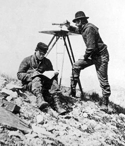
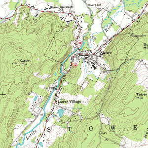
margin: 2px 10px 2px 10px !important; topo surveyorA Topographic Surveyor also known as Topo Surveyor collects the survey data to locate man-made and natural marks and its elevations on a particular portion of land. It normally comprises any man-made underground marks such as utility lines. It will also illustrate ground level installations such as utility poles, buildings, walls, and many other significant installations.

The utilization of standard topographic surveying procedures are commonly employed to provide accurate measured plan of terrain. It is also used during the mapping and graphing phases of projects to blueprint the locations and layout of the installations, road, buildings, and many other engineering and architectural projects in the construction industry.

Why Hire a Topo Surveyor?

The purpose of getting a Topo Surveyor to do topographic survey is to obtain an accurate trace and documentation of the present state of a parcel of land that will be constructed on; either a building, a wall, or any other construction activity. The design engineers make use of the topo survey as they plan the design and then the proposal of the final surface.

It is important to have this plan as this allows the Engineer compute, analyze, and estimate the amount of earth work that might be required. The Engineer will also be able to balance the amount of earth work to minimize the dirt to be taken off and on the construction site. The architect also makes use of the topo survey the same way as the Engineer does.

Additionally, the architect may plot the surface in 3D to picture out the finished look with the improvements he might add. This plot may be presented to the construction owner, building owner, or the land owner before the actual construction takes place. An accurate topo survey is of big help to ensure the installations and improvements fits in on the site within its boundaries.

Common Methods that a Topo Surveyor use

topo-surveyorThe two common methods of doing a topographic survey are Aerial Topo Survey and Conventional Topo Survey. How the topographic survey done would vary on the method the Topo Surveyor use. It is important that a topo surveyor know how to carry out both in any circumstances. So if you will need one, make sure he is professional and experienced both methods.

An Aerial Topographic Survey is done on the airspace. It is taken either in a helicopter or in an airplane at a defined distance above the ground level. Aerial photos of the ground surface are then taken and examined by the topo surveyor. This will allow him to envisage the ground surface through the structure of a stereo pair. By looking at the two overlapping aerial photos, the vantage points are determined.

A Conventional Topographic Survey is done when there is a need to get the accurate contour interval and spot elevations. The Aerial Topographic Survey is limited in the precise vertical and horizontal point location of the ground surface. These are just simplified elaboration of the two methods of topographic survey to provide you an overview. Read and research to learn in depth about them or ask a topo surveyor.


If you need a Topo Surveyor, Please call Phenix City Land Surveying today at (334) 408-4311  or fill out a contact form request for more information concerning your land surveying needs.